
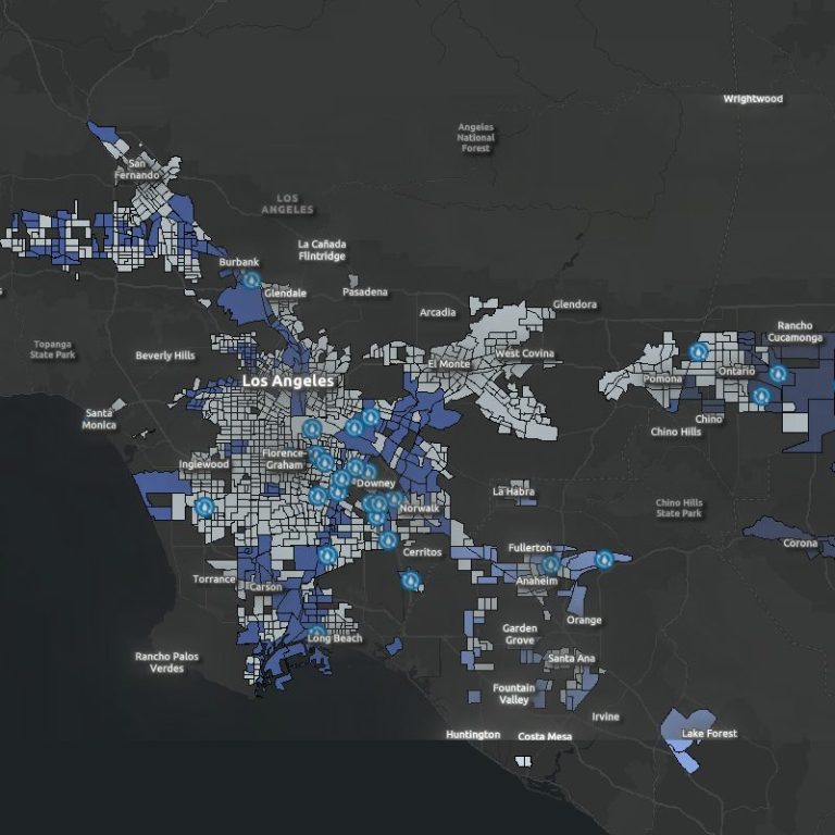
ARCGIS Maps
I use GIS to develop data visualizations that help viewers better understand social, enviornmental, and economic topics. Although I have conducted more data visualization work, I am skilled in data management and analysis. I have developed automation tools to be used within ArcGIS softwares, and continue to grow my skillset in this field.
As you review these maps, please feel free to contact me if you have any questions or would like to learn (or teach) more about them!
Transporation Planning
I am adamant about avoiding car use. Outside of the environmental benefits, I simply don't enjoy driving. The expansion of walkable cities and development of bike lanes is statistically better for community health and overall well-being. The added bonus is we break the cycle of inaccessible cities!
Please follow up with me to learn about the following comparative maps:
- Bike ban policies in relation to motorist-cyclist collision rate
- Bike lane implementation and cyclist mortality rates
- Bike lane type map (Class 1, Class 2, Class 3)

Featured Maps


Environmental Land Use Planning
These specialized maps provide critical information for:
- Water Infrastructure - Visualizing water resources, distribution networks, and conservation priorities
- Green Space Access - Identifying community access to parks and natural areas
- Fire Mitigation - Mapping vulnerable areas and strategic planning for wildfire prevention
These resources are designed to support informed decision-making and sustainable development in our communities. Please explore our maps to better understand local environmental challenges and opportunities.

Nulla euismod condimentum felis
Lorem ipsum dolor sit amet, consectetur adipiscing elit. Nulla euismod condimentum felis vitae efficitur. Sed vel dictum quam, at blandit leo.

Nulla euismod condimentum felis
Lorem ipsum dolor sit amet, consectetur adipiscing elit. Nulla euismod condimentum felis vitae efficitur. Sed vel dictum quam, at blandit leo.

Help make a change
We need your consent to load the translations
We use a third-party service to translate the website content that may collect data about your activity. Please review the details in the privacy policy and accept the service to view the translations.